Day Hikes in North Patagonia: Bariloche
Patagonia unofficially starts at the Río Negro, around latitude 40°S on the Andean side of Argentina. San Carlos de Bariloche (or simply Bariloche) is just a degree south of the river and is the gateway to north Patagonia. Situated on glacial Lake Nahuel Huapi, the town has a Swiss Alps feel and is known for its dreamy chocolate (Try the conitas and alfajores - sinful!) and endless menu of outdoor sports.
Click any photo for a larger slideshow…


Depending on the season, there is so much to do in Bariloche that it’ll make your head spin! Swimming, boating, kayaking, hiking, paragliding, and mountain biking are just a few of the obvious ways to spend the day. We visited in early Spring, so water activities were out of the question. But we did enjoy day hiking around the area and the weather cooperated. The temperature was around 40-45 degrees Fahrenheit in October, with mild wind and sunny skies most days.
Below are three day-hikes in Bariloche, each with endless views. All are accessible by public bus. If you have a Sube card (e.g. from the metro system in Buenos Aires), you can use it on the buses in Bariloche. You can also buy and charge a Sube card at any convenience store in Bariloche.
Day Hike #1: Sendero Campanario (30 minutes)
Sendero means “trail” in Spanish. This is your warm up hike, as it’s only 30 minutes to the top of Cerro Campanario. The hike is short, but steep. Or, you can simply ride the chairlift. Whichever you choose, do not miss the views at the top! There’s a coffee shop with terrific apple pie and platforms providing 360 degree panoramas of the fabulous Patagonian landscape, including Lake Nahuel Huapi, Lake Perito Moreno and the landmark mountain peaks in the region. Welcome to wonderland!!


How to Get There: Take bus number 10 or 20 from the town center. Tell the driver to let you off at Cerro Campanario at (kilometer) marker 17.5. He or she will announce it, regardless. The trail is across the street from the bus stop, up a small gravel driveway. It is well-marked and easy to follow.
Hike #2: Sendero Cerro Llao Llao and Villa Tacul (10 miles)
You ate a double batch of alfajores and conitas last night and now you’re looking to shed the guilt (I’ve been there!). Head to Cerro Llao Llao (pronounced “Shao Shao”) to get the heart pumping and body working. This trail gives you the views beyond the forested peninsula that you couldn’t see yesterday from Cerro Campanario.
Map credit: https://trekbariloche.com
Trail split
From the trail head about 1/2 mile up the road from the bus stop, the path is well-marked and easy to follow. The first section is relatively flat and forested, with tall swaying pines. When you reach the trail split, take the route for Cerro Llao Llao to ascend the mountain. This trail takes about 30 minutes to reach the top, with scenic overlooks of the lake and surrounding mountains along the way.
Click any photo for a larger slideshow…


There’s a sign that clearly marks the end of the trail at the top of the hill. In my poor Spanish, I thought it advised “End of the trail. Return for wine.” LOL! :-)
After photos at the highest viewpoint, descend back along the same trail and then hike to the beaches of Villa Tacul along Sendero Arrayanes.
The trail from this point is pretty flat, mostly following the coast line along the peninsula. There are some picnic areas and sandy beaches that are warm and sunny, even in early Spring. We shared the trails with just a handful of people and plenty of sweet chirping birds.
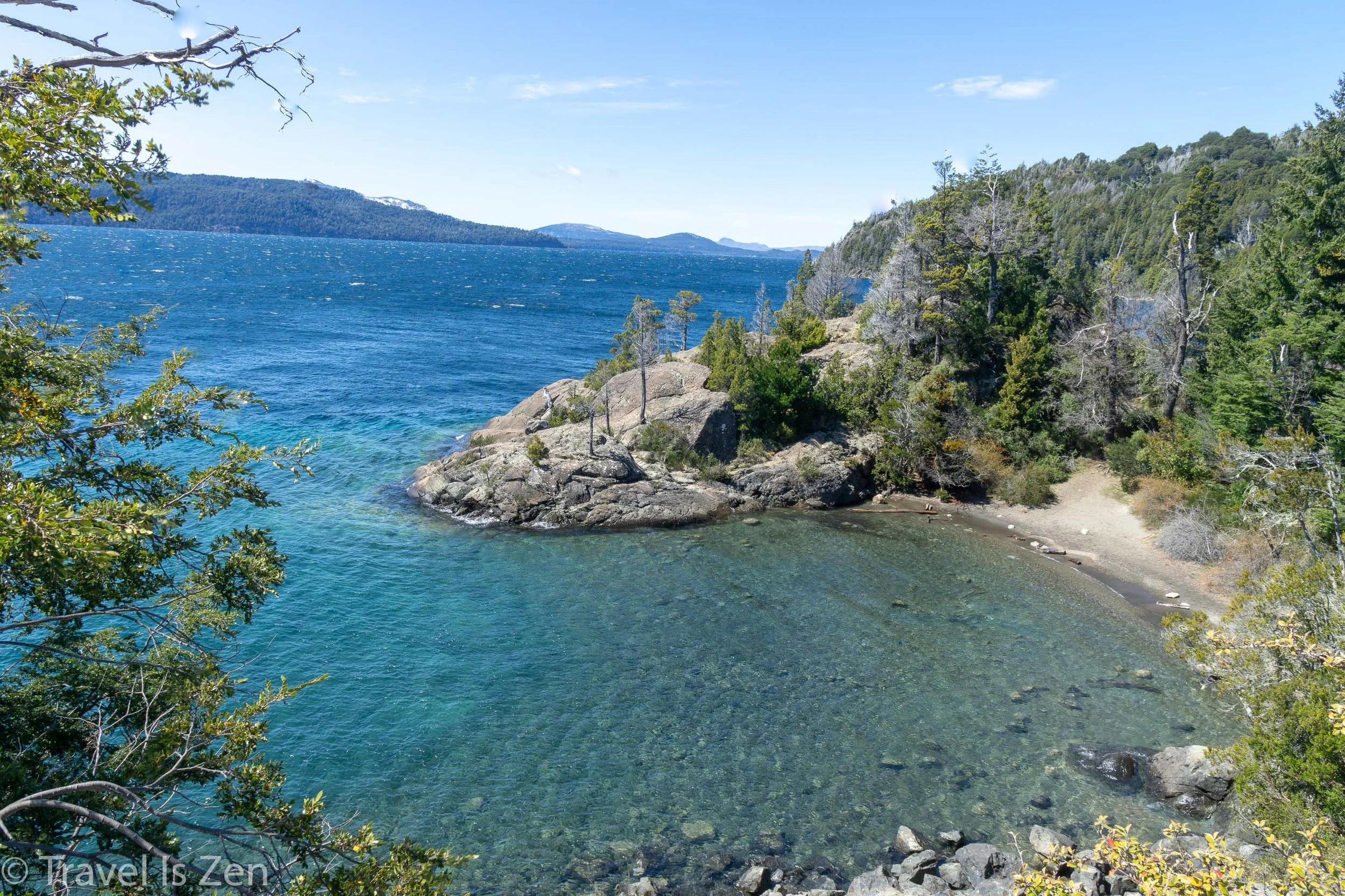


How to Get There: Take bus number 20 from the town center. Tell the driver to let you off at Puerto Panuelo, which is the second to last stop on the line. If you end up at Hotel Llao Llao (last stop), no worries. You can just walk down the hill to the Port and then turn left. From the Port, follow the road until you reach the trailhead, about 1/2 mile.
Hike #3: Cerro Otto (6 Miles)
Warning: This is a very steep trail!!
Cerro Otto is terrific day hike that provides an overlook of the entire city, the lake and nearby islands. Many of the hiking maps for Bariloche show a hiking trail near the Cerro Otto cable car, but the tourist information office advised us not to use that route because it passes through a “neighborhood with limited resources”. Apparently there have been a few hiking robberies and may not be safe. We found a different route on Maps.Me. (See “How to Get There” below.) The initial ascent is crazy steep! But once you get out of the pine forest, the views are terrific!


At the end of the 4x4 road is a private entrance to the cable car station and a restaurant with a panoramic view, similar to the free view at the top of Cerro Campanario. We did not pay the entrance fee. Instead, we turned around and had lunch on a rock outcropping overlooking Bariloche. As we were eating, a dozen men and women hopped out of a van with large backpacks and, within minutes, were parasailing off the cliff next to us. Entertaining!


The 4x4 road is across the street from the gas station on Avenue de los Pioneros
How to Get There: There’s a dirt road on the opposite end of town from the cable car that you can follow all the way up to Piedras Blancas. You can hike the road, or, find the mountain biking trails and a trekking path at the start of the 4x4 road. They are in the pine forest on the left hand side of the road.
We followed the white flag and round orange markers to the top, near Piedras Blancas, where the trail then levels out. Once you get to Piedras Blancas, it’s mostly dirt road unless you follow the cross country ski trails.
Best Time to Visit Bariloche, Maps, Useful Links

Photo credit + more maps at: https://trekbariloche.com
Bariloche is a four-season sports town. In the winter, there’s a ski resort, with snow mobile, cross country and downhill trails. In the spring and fall, enjoy mountain biking, paragliding, horseback riding, and hiking. As the weather and lake warms, water activities abound. When is the best time to go? Depends on your hobbies! Accommodation prices in the early spring (October), when we visited, were about half the price as in summer months and widely available. But a few of the popular trails, such as the Refugio Frey trail on Mount Cathedral, were snow packed and icy. You can still hike, but you will need crampons and snowshoes.
We offered three day hikes in and around Bariloche, but there are many other longer-distance trails and multi-day circuits. A terrific list of all outdoor activities in Bariloche, along with trail and regional maps, is here: https://www.barilocheturismo.gob.ar/en/hiking. This site is a good resource for trekking information in Bariloche: https://trekbariloche.com. When you arrive in Bariloche, you should also visit the Tourist Information center and Club Andino Bariloche for the latest trail conditions, maps, bus schedules, gear rental, and more.
How to Get to San Carlos de Bariloche
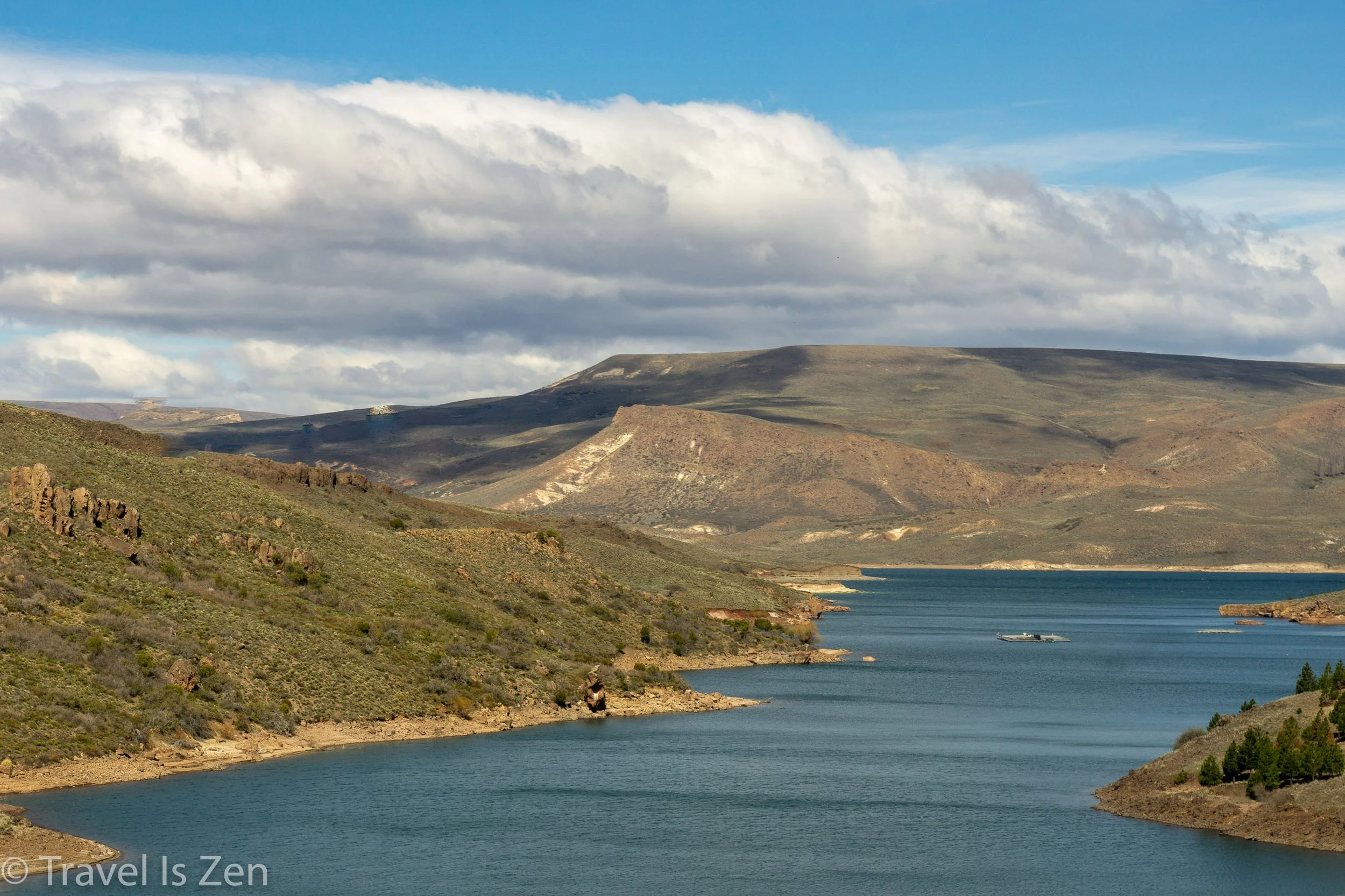
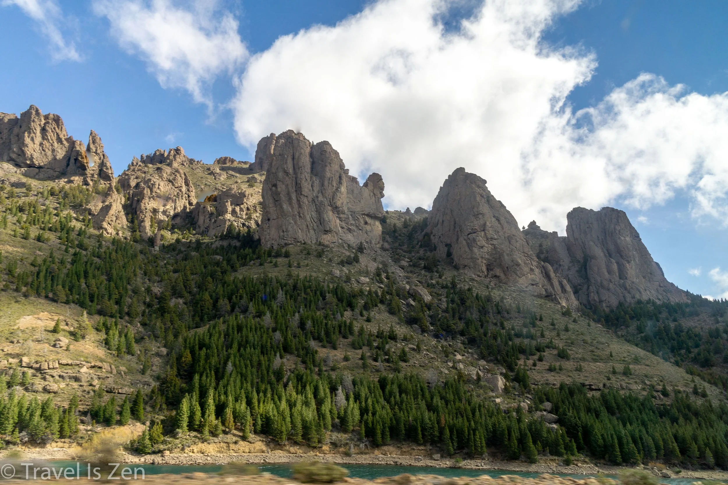
There are flights from Buenos Aires to San Carlos de Bariloche. Flight time is 2 1/2 hours and the price was about USD$120 in October 2018. Prices fluctuate like a bouncing rubber ball in Argentina, though, so check the Argentina peso to US dollar rate. When we visited, it was 37:1 (37 pesos to 1 dollar), which was highly in our favor.
We were in wine country before heading to Patagonia. There are no direct flights between Mendoza and San Carlos de Bariloche (or between Salta and Bariloche). Flights required criss-crossing the country back to Buenos Aires and then to Bariloche. We opted to take an overnight 24 hour bus ride from Mendoza to Bariloche, which cost about USD$60 per person (Oct. 2018). The views from the bus as we traversed the pampas steppe into the foothills of the Andes Mountains was incredible. Worth the hours on the bus.